CLAMS - Coastal Landscape Analysis and Modeling Study
Project summary
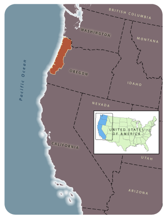
The Coastal Landscape Analysis and Modeling Study (CLAMS) was a multi-disciplinary research effort with the main goal to develop and evaluate concepts and tools to understand pattern and dynamics of provincial ecosystems such as the Oregon Coast Range, and to analyze the aggregate ecological and socio-economic consequences of different forest policies and strategies across multiple ownerships of the province. The project was active from 1996 to 2002. LEMMA's contribution to the project was to provide the gradient nearest neighbor (GNN) forest vegetation map that characterized the initial forest conditions (based on 1996 Landsat TM imagery), from which alternative forest management policies could be evaluated. The GNN method for predictive vegetation mapping (Ohmann and Gregory 2002) was first developed as part of CLAMS.
GNN Map Products for CLAMS
GNN maps developed for CLAMS have been replaced by more current versions, available on our data download page.
Collaborators and Support
CLAMS was a multi-disciplinary research effort sponsored cooperatively through OSU's College of Forestry, the US Forest Service's Pacific Northwest Research Station, and the Oregon Department of Forestry. The GNN component of CLAMS was partially funded by the Forest Inventory and Analysis (FIA) Program, Pacific Northwest Research Station (PNW), USDA Forest Service.
Publications, Reports, and Presentations
Loading publications ...