Project Descriptions
This page describes the current and past projects of the LEMMA
team. Please click on a project to go to that project's web pages.
For a complete list of currently available map products, visit the
model download page.
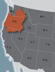
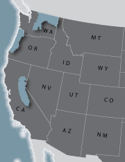
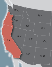 | CA-Biomass - Forest Biomass Mapping in California and Western OregonOngoingIn this project, we are continuing the development of an integrated system for monitoring forest carbon and biomass dynamics (see CMONster below) in California and Western Oregon. This system leverages USDA Forest Service Forest Inventory and Analysis (FIA) data and fitted Landsat imagery based on the LandTrendr algorithms. In particular, this project incorporated satellite imagery from multiple Landsat missions (Landsat 5, 7, and 8) and 16 years of FIA plot data to understand the patterns, causes, and consequences of biomass stock status and change, especially as it related to forest disturbances (e.g., drought-induced mortality, wildfire, etc.). Additionally, this work aimed to better understand uncertainties in resulting forest biomass maps to inform their use by land managers, policy makers, and scientists. |
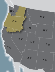
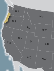
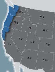 | NWFP - Northwest Forest Plan Effectiveness MonitoringOngoingThis project involves developing detailed maps of forest vegetation for multiple dates across the Northwest Forest Plan (NWFP) area in Washington, Oregon, and California. The maps are used in Effectiveness Monitoring for the NWFP, to assess changes in late-successional and old-growth forest, and habitat for the northern spotted owl, marbled murrelet, and aquatic species. Maps developed for the 15-year report (completed in 2010) were for two dates: 1996 and 2006 in Oregon and Washington, and 1994 and 2007 in California. The current map dates, used in the 20-year report, are for 1993 and 2012 across the entire NWFP area. Whereas all maps were developed using gradient nearest neighbor (GNN) imputation based on Landsat time-series (LandTrendr) data, the current maps incorporate new plot data and several improvements to modeling techniques. |
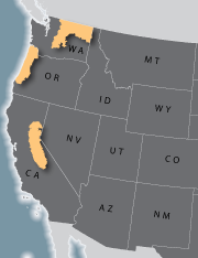
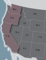 | CMONster - Carbon Monitoring for Wooded EcosystemsOngoingIn this project, we are building an integrated system to monitor carbon dynamics for all forests and woodlands of Washington, Oregon, and California from 1985 to present. The system will improve understanding of the patterns, causes, and carbon consequences of forest dynamics over areas large enough to 1) directly address fundamental science questions, and 2) evaluate the actual history of forest management across a range of ownerships, forest types, and climatic conditions. The system will be designed to accommodate new or improved tools, algorithms, and data as they become available, and will explicitly provide estimates of uncertainty in carbon pools and fluxes to independently evaluate the significance of trends across space and time. GNN maps will be based on the most current available Landsat TM imagery, processed using the LandTrendr algorithms. |
 | LiGNN - Lidar Integration with GNNCompleted 2014The purpose of this project was to assess the benefits of incorporating light detection and ranging (lidar) data and disturbance history derived from multi-temporal Landsat imagery (LandTrendr) into regional predictive mapping of vegetation using GNN. GNN maps developed using regional inventory plots and Landsat data are appropriately used to inform regional or "mid-scale" land management planning, policy formulation, and monitoring, but are not expected to be sufficiently accurate to support stand-level management decisions. This project investigated whether incorporating vegetation metrics derived from lidar point clouds and disturbance history derived from multi-temporal Landsat imagery as spatial predictors in GNN can yield vegetation maps that are sufficiently accurate for use in local-scale management. Additionally, this project evaluated the effects of 1) more precise GPS geo-referencing of inventory plot locations, and 2) use of inventory plots versus subplots, on GNN map accuracy. This project was conducted on the Deschutes National Forest in central Oregon. |
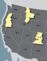 | NaFIS - Nationwide Forest Imputation StudyCompleted 2009The goal of the Nationwide Forest Imputation System (NaFIS) project was to evaluate methods that could be used to produce nationwide data products using nearest neighbor methods. Primary needs for national maps are to provide spatially explicit and statistically valid large- and small-area estimates of forest attributes measured by the Forest Inventory and Analysis (FIA) program of the U.S. Forest Service, and to provide detailed data needed for national risk mapping of multiple forest threats. The project used forest inventory data, satellite imagery and ancillary data, and nearest neighbor techniques to construct moderate- (30-m-) resolution datasets of forest attributes to satisfy three strategic objectives: (1) to support spatial applications such as risk estimation, natural resource planning, and landscape scenario analyses; (2) to construct forest attribute maps; and (3) to distribute forest inventory data within spatial contexts. We produced pilot Random Forest nearest neigbhor (RAN) map products corresponding to USGS mapzones 7 (Oregon), 19 (Montana/Idaho), and 28 (Colorado) for 2000 Landsat TM imagery. |
 | IMAP - Interagency Mapping and Assessment ProjectCompleted 2008The Interagency Mapping and Assessment Project (IMAP) uses a variety of modeling tools and data needed by policy makers, land managers, and others to evaluate alternative land management approaches. IMAP aims to provide tools and data that are easy to use and understand, economical to apply, and that provide a reasonable representation of the implications of vegetative succession, management, and natural disturbances. Mid-scale assessments and plans are needed by many state and federal agencies, organizations, and others. Key issues for analysis and planning efforts include integrating fire risk, fuel conditions, wildlife habitats, old forests, forest products, rangeland conditions, potential biomass supplies, carbon sequestration, and others. LEMMA's contribution to this project was to provide the initial GNN vegetation model (based on 2000 Landsat TM imagery) which is integrated into IMAP's VDDT modeling approach. In addition, LEMMA produced a GNN model for a pilot project called the Central Oregon Landscape Assessment (COLA) project in 2004. |
 | PNW ReGAP - Ecological Systems MappingCompleted 2008As part of the Northwest Gap Analysis Program, land cover maps were generated for USGS mapzones 2, 7, 8 and 9, covering Oregon, eastern Washington, and parts of Idaho, Nevada, and California. The project goal was to develop land cover maps and databases that provided information on the status of the vegetation and habitats, taking advantage of existing information but applying some new techniques. This was done as two separate but related projects. For mapzones 8 and 9, the map of Ecological Systems was derived from two primary components: SAGEMAP and SWGAP for nonforest areas, and GNN for forested areas. The nonforest and forest components were integrated to create the final maps. For mapzones 2 and 7, spatial modeling of Ecological Systems was done by building two Random Forest (RF) models, one for forested Ecological Systems and one for nonforested Ecological Systems. We then applied a variety of ancillary spatial data to map those Ecological Systems that we could not model well. |
 | GNNViz - Interactive Visualization of GNN ModelsCompleted 2007In this project, we developed innovative ways to visualize and interact with broad-scale mapped information on fuels and vegetation, to improve communication between researchers and managers as well as to enhance delivery and use of our own and similar research products. As part of this project, we created 3-D interactive and immersive tours of our three GNNFire study areas using state-of the-art computer gaming technology and detailed data from existing GNN vegetation and fuels maps. In addition, we coupled these visualization tools to the underlying GIS data and provided users with on-screen and real-time displays of GNN attributes based on user location within the visualization environment. The methodology for creating this visualization environment was generalized to be extendable to other locations and mapping methods. |
 | GNNFire - Forest Fuels and Vegetation MappingCompleted 2005GNNFire examined the utility of the Gradient Nearest Neighbor (GNN) method to predict fuel patterns in three prototype landscapes in coastal Oregon, northeastern Washington, and the California Sierra Nevada, which encompassed vegetation from dense forests to rangelands in a mosaic of natural and human-dominated environments. We developed a methodology for using multivariate statistical models and imputation to simultaneously map fuel characteristics, species composition, and forest structure as continuous variables across environmentally heterogeneous, multi-ownership landscapes using inventory plot data, remote sensing imagery, and environmental GIS data layers. We applied this methodology to generate vegetation and fuel maps for pilot landscapes located in three distinctive ecoregion divisions in the western US. We produced GNN map products corresponding to 2000 Landsat TM imagery in Washington and California and 1996 Landsat TM imagery in Oregon. |
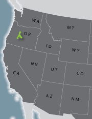
 | CLAMS - Coastal Landscape Analysis and Modeling StudyCompleted 2002The Coastal Landscape Analysis and Modeling Study (CLAMS) was a multi-disciplinary research effort with the main goal to develop and evaluate concepts and tools to understand pattern and dynamics of provincial ecosystems such as the Oregon Coast Range, and to analyze the aggregate ecological and socio-economic consequences of different forest policies and strategies across multiple ownerships of the province. LEMMA's contribution to this project was to provide the initial GNN forest vegetation model (based on 1996 Landsat TM imagery) from which alternative forest management policies could be evaluated. |