The GNNViz Project
Project summary
In this project, we proposed developing innovative ways of visualizing and interacting with broad-scale mapped information on fuels and vegetation to improve communication between researchers and managers, as well as to enhance delivery and use of our own and similar research products. Our objectives were to:
- Create an interactive and immersive tour of our three study areas using state-ofthe-art gaming technology and detailed data from existing GNN vegetation and fuels maps. The methodology for creating this visualization environment would be generalized to be extendable to other locations and mapping methods
- Couple these visualization tools to web-based map server technology to give the user analytical tools for querying the underlying GNN mapped attributes and the ability to overlay polygon and raster information from external sources into the visualization environment.
We created the visualization environment for our three GNNFire study areas and developed an application that is extensible to other mapped information and geographic locations. The research path taken to arrive at this application was not always as proposed, and many of our key findings speak to the evolutionary nature of developing software that relies on changing technology. The software morphed from a paired visualization environment and web-based mapping site, as outlined in our objectives above, into an integrated visualization and analysis platform. We created a tool for visualizing and browsing spatial information that is unique from GIS – a hybrid experience between GIS, Google Earth, and a computer game. We believe this platform holds promise for future visualizations and simulations.
GNNViz Gallery and Development Journal
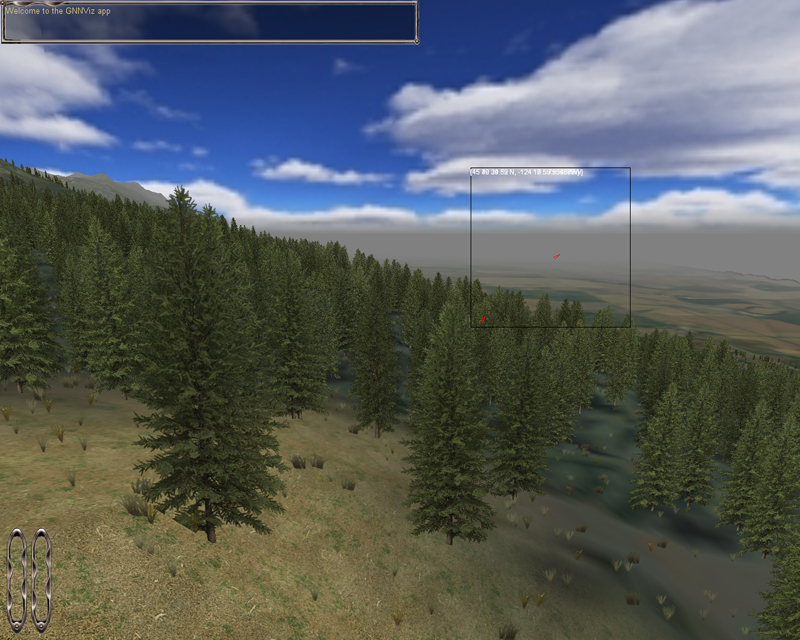
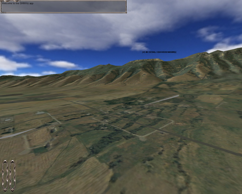
Below are a collection of images and movies generated in GNNViz during its ongoing development. All renderings are taken real time, in the game environment, where the user has full control of where they look and go in the 3D space modeled.
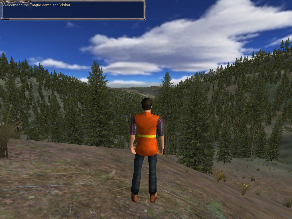
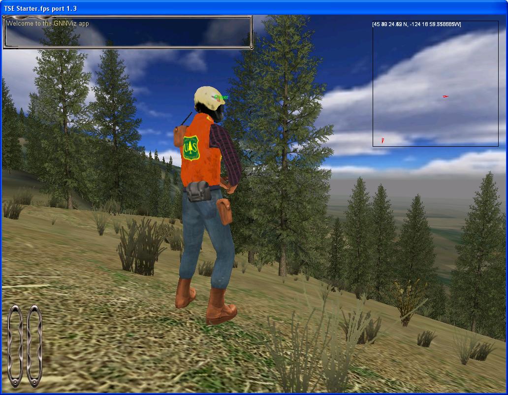
We show images from two different incarnations of GNNViz, the first using the current game engine -- Delta3D -- and the second showing an earlier prototype based on the Torque game engine. One of the biggest challenges of this project was choosing a game engine that could meet all the requirements of the forest visualization. We found the Torque game engine to have difficulty creating topographic surfaces from digital elevation models (DEMs) and was ultimately unusable.
Videos from the Delta3D Game Engine
These videos represents different functionality within GNNViz.
- Example of multi-player functionality
- Fly-through of California study site
- Streaming attribute data
- Tree view of a sample landscape
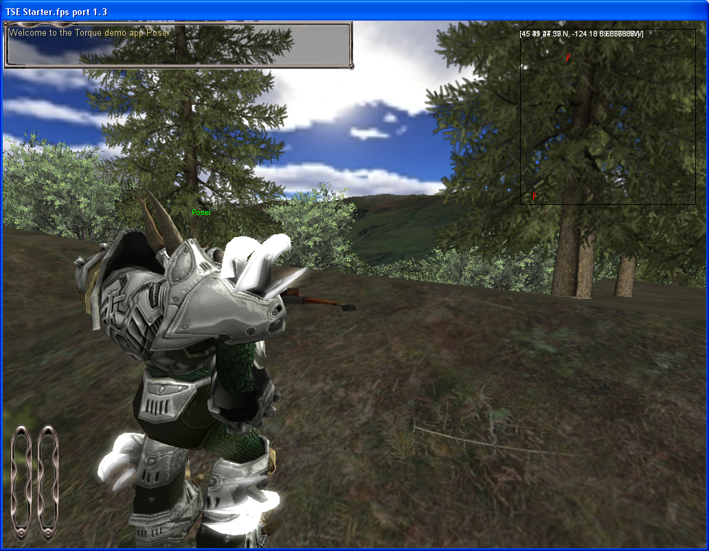
Videos from the Torque Game Engine
To get a sense of the movement and scale possible in the GNNViz system, here are two short demo videos.
Video 1 - a demo video showing GNNViz using the Torque engine.
Video 2 - a short video showing GNNViz with the simulated fire and smoke of a forest fire.
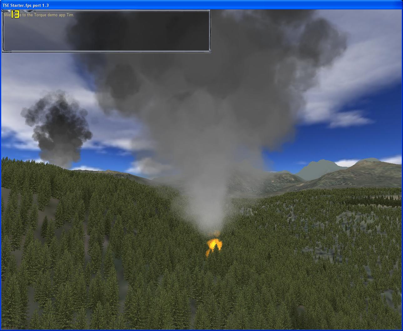
Fire Simulation
One of the potential applications of the GNNViz technology is the visualization of forest fires for various applications, including modeling fire behavior and effects and forest-fire training. This image was taken from a special test version of GNNViz that shows simulated fire and smoke in the 3D environment.
|
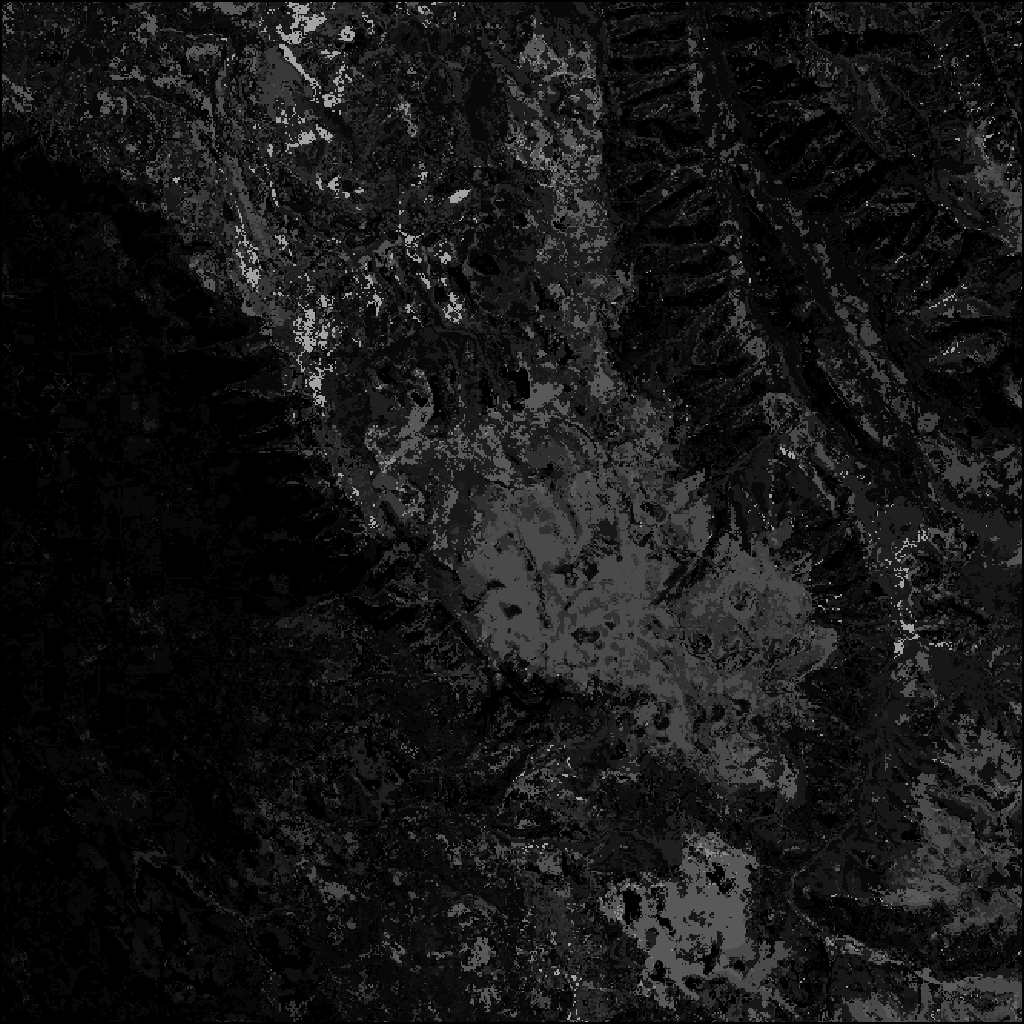
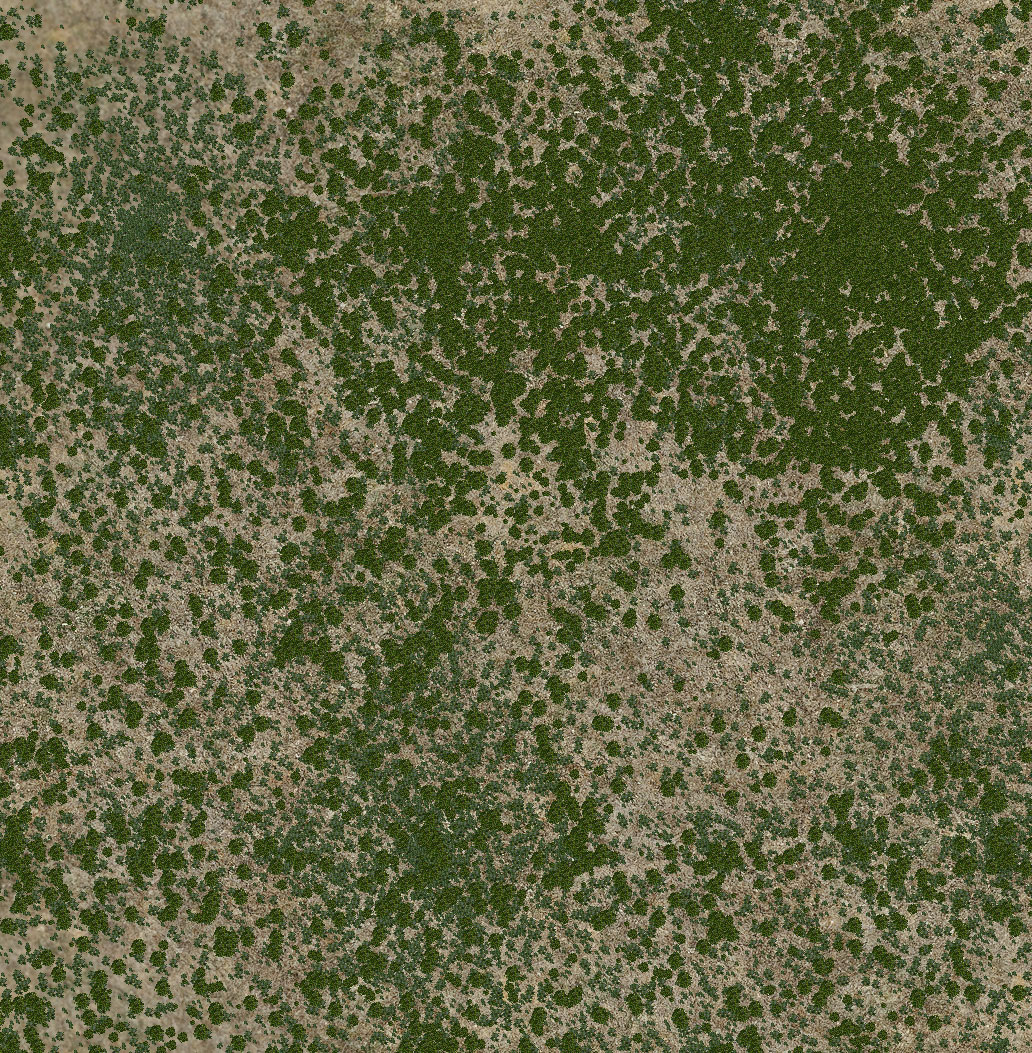
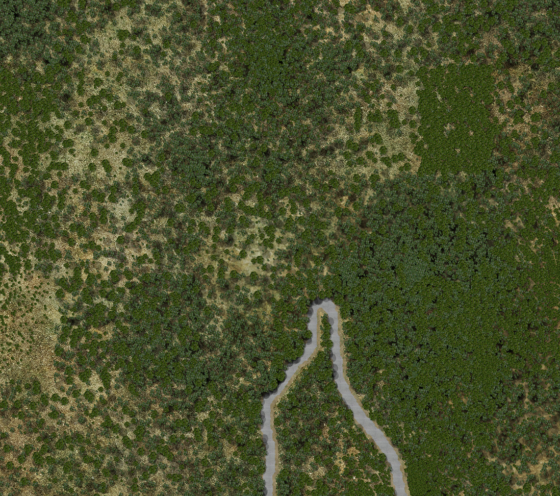
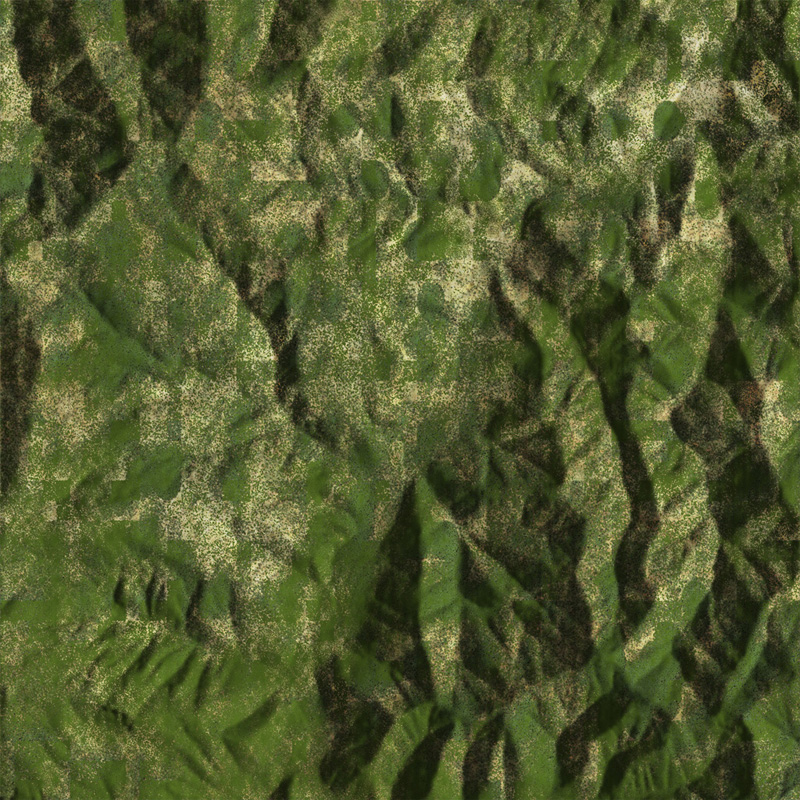
Foliage Masking
To manage precise foliage placement in GNNViz, we used a technique called "Foliage Masking". It lets us create a mask image that guides where plants should and should not be.
Note that the mask does not need to be black and white. The intensity of each pixel in the mask is used to determine the odds of a foliage item being placed on that location, with black meaning no plants, and white meaning normal/full density of plants. Shades of gray handle plant densities in between.
|
|
|
|
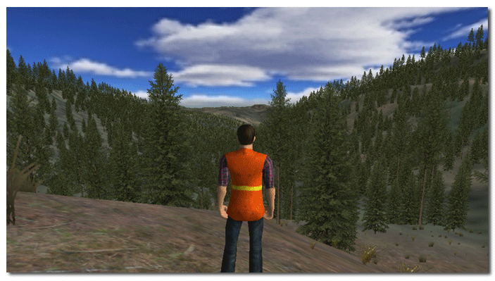
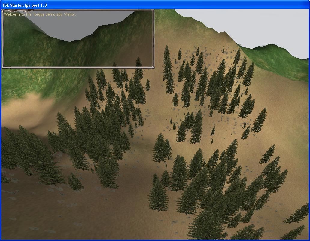
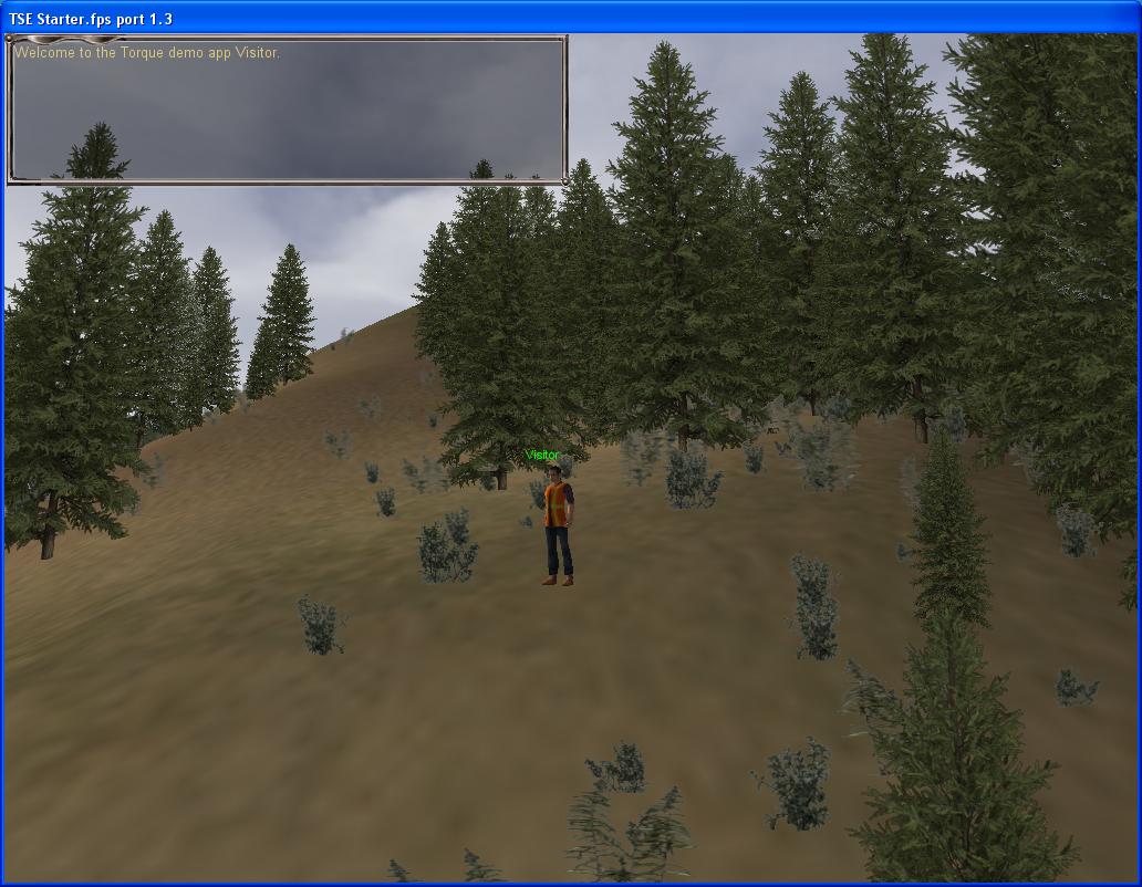
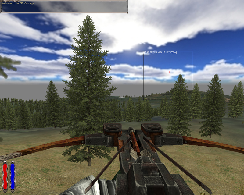
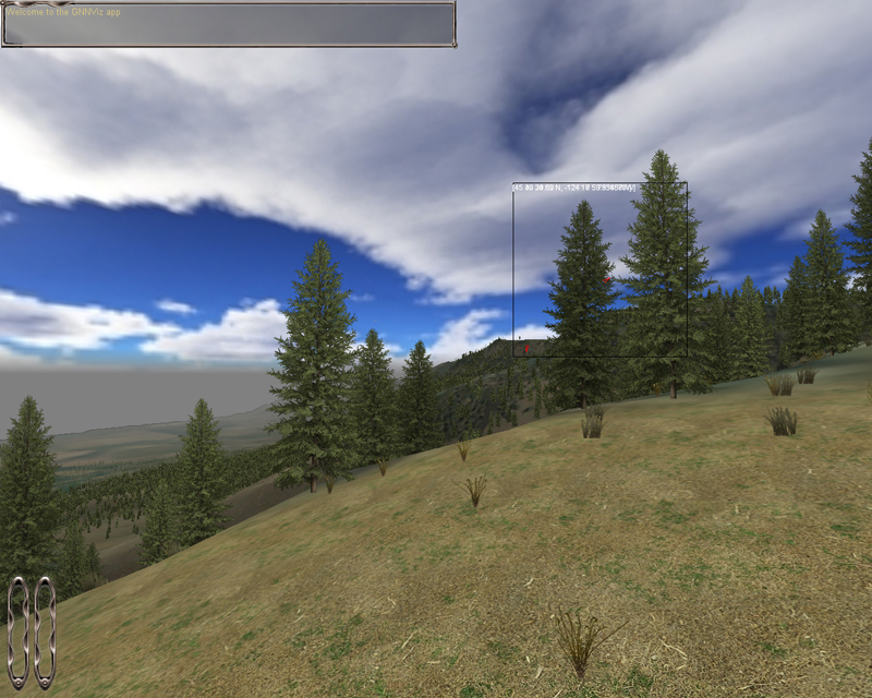
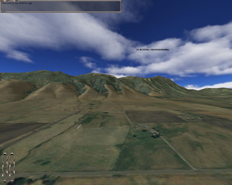
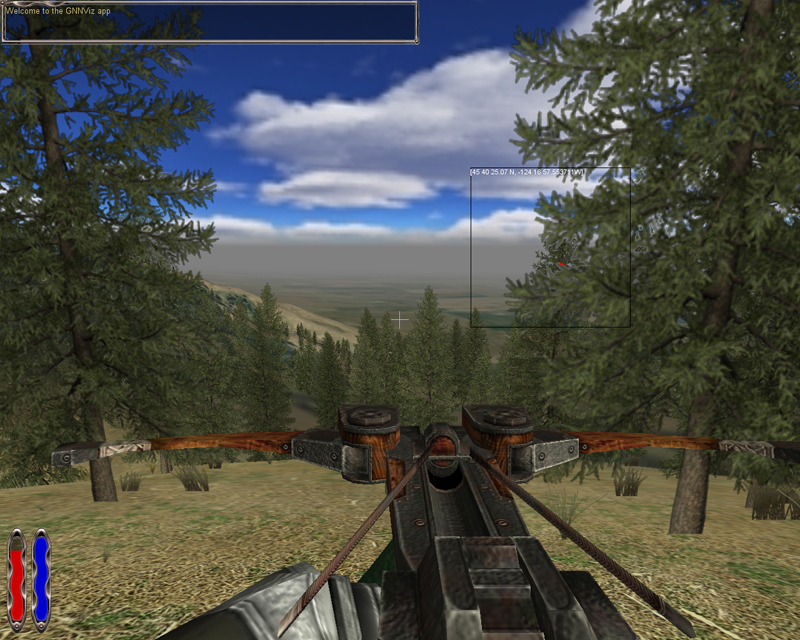
Blue Mountains, Oregon
One of the first areas modeled was in the Oregon Blue Mountains region.
Strong terrain variation and mixes of forested and non-forested areas make
it an interesting area for visualization.
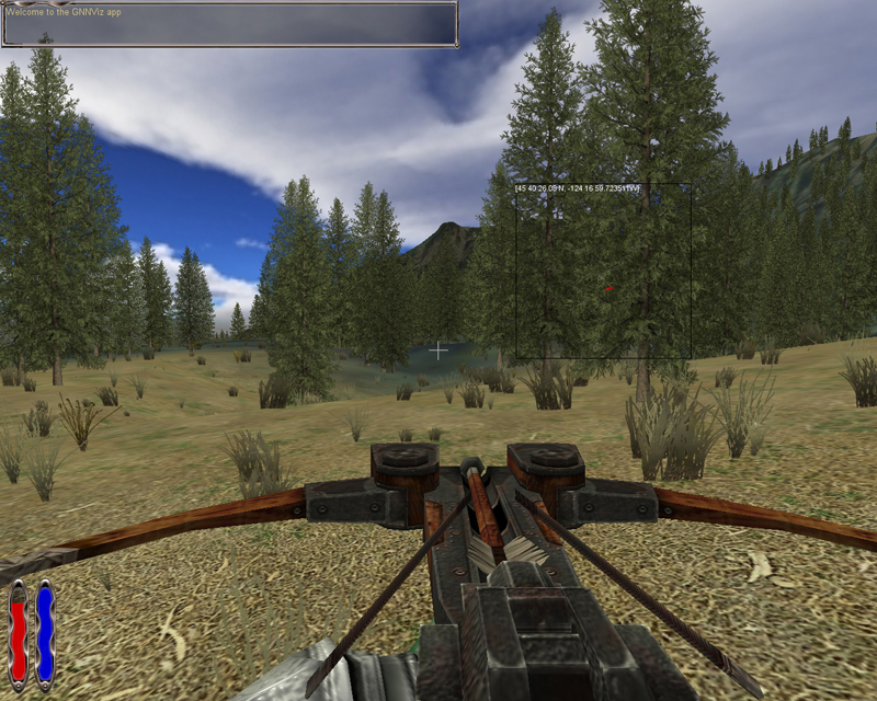
Note that in some of the images the player is carrying a crossbow. This
is no longer present in GNNViz, and was a leftover from the game
technology being used. Perhaps we should put a
Pulaski in
the player's hands instead!
|
|
|
|

|
|
|
|
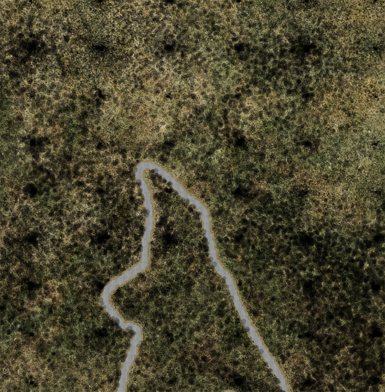
Simulated Satellite/DOQ Imagery
The actual foliage coverage and distribution in the GNN dataset does not necessarily match the coverage available from DOQ and satellite imagery. To prevent visual errors caused by the terrain overlay image not matching the actual dataset, we explored creating "fake" overview images to be drawn on top of the digital terrain in GNNViz. Here are several examples of derived images, including some that are just the ground image with no trees visible, just the ground texture and the tree shadows.
|
|
|
|
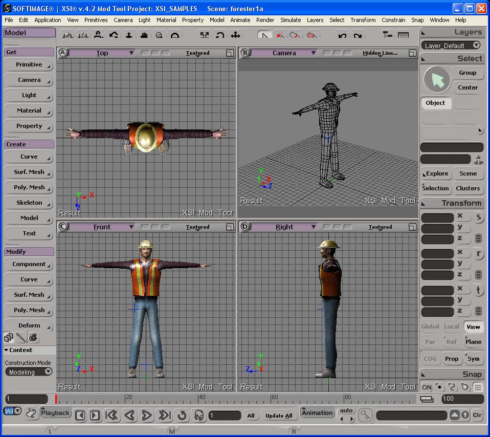
Player Model
Each person using the GNNViz tool is represented by a scale character model known as an Avatar. The player avatar moves, walks and behaves somewhat naturally as the user moves about the landscape. Below are images of various player models that have been used in the GNNViz simulation during its development.
|
|
|
|
Project Support
The project was funded by the Joint Fire Science Program as Project 05-4-1-12.
Publications, Reports, and Presentations
Loading publications ...